

The MOUNDS and RACINES projects: ancient societies shaped the forests of the Congo Basin

The MOUNDS and RACINES projects: how ancient societies shaped the forests and wetlands of the Congo Basin

From 06 July 2026 to 13 July 2026

Likouala-Mossaka, in the north of the Republic of the Congo

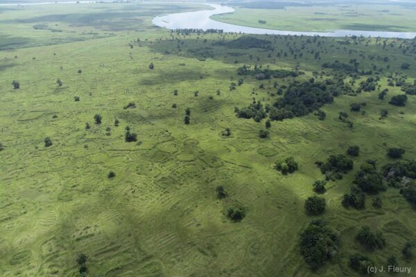
In May 2026, the MOUNDS* and RACINES** projects, supported by the One Forest Vision initiative and the French Embassy’s BGF-SCAC programme***, carried out a three-week scientific mission in the Likouala-Mossaka region, in the north of the Republic of the Congo. This field campaign, involving researchers from several disciplines, aimed to gain a better understanding of the long-standing interactions between human societies and the forest and wetland ecosystems of the Congo Basin. At the heart of the research were raised fields – impressive agricultural structures built to enable cultivation in areas subject to seasonal flooding. These structures, some of which may date back more than 800 years, bear witness to a human and environmental history far more complex than previously imagined.

20260523_165619.jpg
Arrivée de la mission scientifique en pirogue dans la région de la Likouala-Mossaka, au nord de la République du Congo. Crédits photos © Yannick Garcin © Yannick Garcin
  • *MOUNDS; “Raised fields as indicators of past human impacts on the peatlands of the Central Congo Basin”
  • **RACINES; “Exploratory work on human–forest interactions over the long term: an archaeological and archaeobotanical project”
  • **BGF-SCAC (French Embassy programme): “French Government Scholarships – Cooperation and Cultural Action Service of the French Embassy”

1. Exploring the traces of ancient landscape engineering

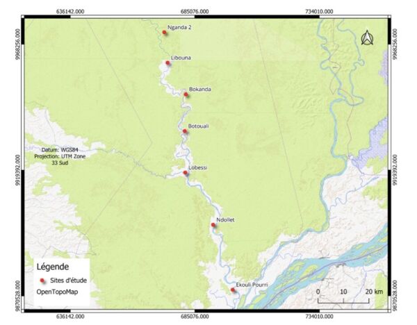
Long regarded as areas that have remained relatively untouched over the centuries, the forests and wetlands of the Cuvette Centrale now reveal traces of ancient human settlement. To gain a better understanding of this heritage, teams from the MOUNDS and RACINES projects have explored seven study areas spread over more than 100 kilometres along the Likouala-Mossaka River.

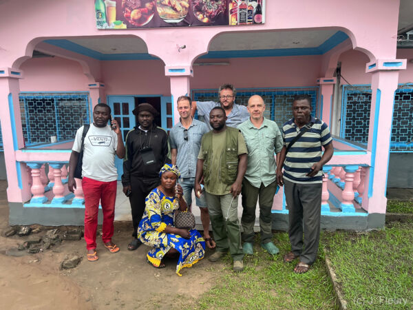
This mission brought together archaeologists (Louis Champion, IRD), geomorphologists (Yannick Garcin, IRD-CEREGE), botanists (Yannick Bocko and Gaël Bouka, UNMG), geomatics specialists (Jules Fleury, AMU-CEREGE and Samuel Kayes, UNMG and CEREGE), geneticists and ethnologists, all working towards a common goal: to reconstruct the history of these human-shaped landscapes and assess their influence on present-day ecosystems.

JFleury_IMG_8093.jpg
Yannick Bocko, UNMG, Samuel Kayes, UNMG et CEREGE ; Yannick Garcin, IRD-CEREGE Gaël Bouka, UNMG Louis Champion, IRD Jules Fleury, AMU-CEREGE, Belle-Vie et St Symphorien © Jules Ferry

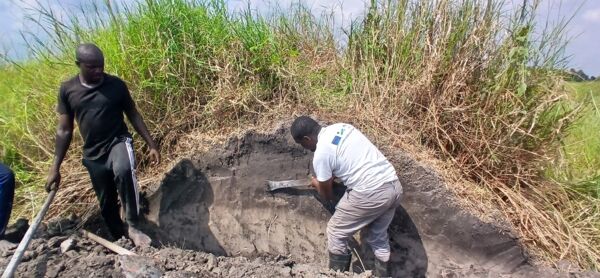
The field campaigns enabled archaeological excavations to be carried out, the structure of the raised fields to be studied, and several hundred samples to be collected for further analysis: radiocarbon dating, soil studies, archaeobotanical analyses, environmental DNA and the quantification of carbon stocks.

2. Cutting-edge technologies in the service of landscape history

One of the innovative aspects of this mission involves the use of a drone fitted with a LiDAR sensor, capable of mapping terrain with a very high degree of accuracy, even beneath forest cover.

This data will enable researchers to reconstruct the spatial organisation of ancient agricultural systems – which are now largely invisible from the ground – and to assess the true extent of the changes made by past societies to the region’s landscapes.

Carte de la mission .jpg
Localisation des sites d'étude dans la région de la Likouala-Mossaka, au nord de la République du Congo © Anthoni Samuel Kayes
Champs surelevé de la Likouala_moussaka. (c) J. Fleury.jpg
Vue drône du site de recherche scientifique dans la région de la Likouala-Mossaka, au nord de la République du Congo © Jules FLeury

3. Local knowledge at the heart of research

Beyond the scientific investigations, the mission placed great emphasis on engagement with local communities. The teams documented current uses of the wetlands, agricultural practices and the traditional knowledge associated with these landscapes.

This interdisciplinary approach enables scientific data to be cross-referenced with local knowledge in order to better understand the continuities and transformations in the interactions between human societies and their environment over the centuries.

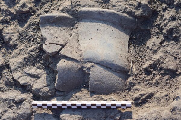
The researchers also discovered new archaeological remains, notably pottery fragments, which will help to clarify the history of human occupation in the Likouala-Mossaka Valley.

20260524_133301.jpg
L'équipe en pleine études des sols et analyses archéobotaniques d’un champs surélevé. © Yannick Garcin
Congo2026_Y_GARCIN-40 (1).jpg
Fragments de céramiques issu de pratiques agricoles trouvé dans les champs sur-élevé dans la région de la LikoualaMossaka, au nord de la République du Congo © © Yannick Garcin

4. A major contribution to our understanding of tropical forests

Analysis will continue over the coming months to determine the exact age of the raised fields and to assess their impact on the forest landscapes, wetlands and peatlands of the Central Basin, now recognised as one of the planet’s major reservoirs of so-called ‘irrecoverable’ carbon.

This mission fully illustrates the ambition of One Forest Vision: to develop interdisciplinary research capable of placing the forests of the Congo Basin in their historical context in order to better inform strategies for the conservation, restoration and sustainable management of tropical ecosystems.


Key figures for the mission

  • Six people were involved in this mission, representing a wide range of disciplines.
  • 7 study sites explored along the Likouala-Mossaka River
  • Over 100 km surveyed in the Central Congolese Basin
  • 1 LiDAR drone deployed to map landscapes under forest cover
  • New archaeological remains discovered during the mission
  • Over 800 years of history revealed by the initial findings on the raised fields 
JFleury_IMG_7793.jpg
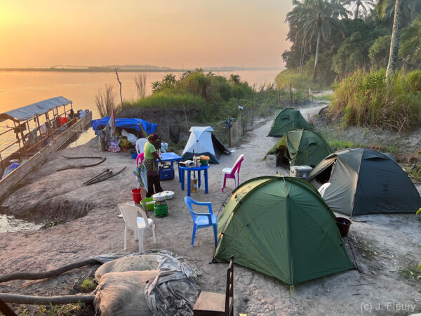
Campement du site de recherche scientifique dans la région de la Likouala-Mossaka, au nord de la République du Congo © © Jules FLeury

5. Spotlight on Samuel, a PhD student at One Forest Vision

This mission also involved Samuel Kayes, a One Forest Vision PhD student, whose research in the humanities, social sciences and geomorphology is helping to improve our understanding of the historical relationships between human societies and the forest landscapes of the Congo Basin. His work illustrates the importance of integrating historical, archaeological and social approaches into research on contemporary environmental change.

Congo2026_Y_GARCIN-287.jpg
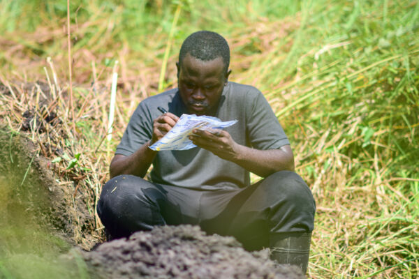
Samuel Kayes, doctorant One Forest Vision sur le terrain en train d'enregistrer un échantillon de sol. © Yannick Garcin

His key message: 
“The forests of the Congo Basin are not just natural areas: they are also the result of several centuries of interaction between human societies and their environment.”  Samuel Kayes, PhD student at One Forest Vision